Today hit around 80F in central Puget Sound, 90F in Portland, and about the same in eastern Washington
Tomorrow will be a minor step down, but soon the thermostat will be turned much lower, with highs in the 60s.
Worried about heatwaves? Don't be...the threat of real heat is over for 2021.
And as a sign of major change, a sharp upper-level trough of low pressure is now approaching the coast, with substantial showers associated with it....something shown by the National Weather Service weather radars at 9 PM (see below), which indicate rain on the Oregon coast.

Don't be surprised if you hear some showers, and perhaps even some thunder, in the early morning hours.
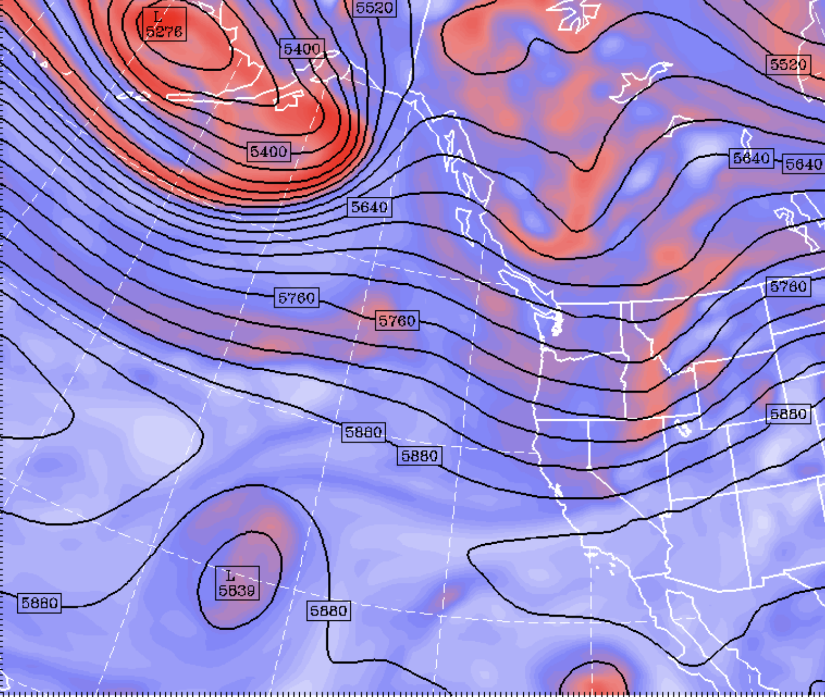
The key change is that the upper ridge of high pressure, which has persisted immediately to our east (see map for 500 hPa...about 18,000 ft ASL... today, below), will weaken

and the Pacific jet stream will strengthen in its wake (see upper-level map for Sunday)
The latest forecast from the European Center ensemble system of many forecasts shows the downward temperature trend this month.


The good news in all of this is that the cooling trend works against wildfire, and there is no hint of the dangerous pattern of last September with strong, dry offshore-directed (easterly) winds.
Post a Comment