I have talked about the rains in my previous blogs and everything is pretty much on track.
I do not want to overhype the event: it will be roughly the same as one of our typical vigorous winter weather systems.
This is not a major atmospheric river event that produces flooding. And that is particularly true because our rivers are starting at relatively low flows. Not a major windstorm. But it will be a shock to many because we haven't experienced a real storm in a long time.
But all said and done, the water vapor satellite imagery is quite impressive this morning (see below). A huge plume of water vapor is heading our way and is now right off the coast.
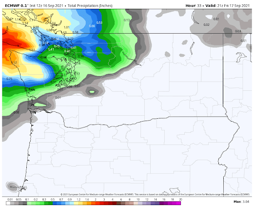
The rain sequence from the last European Center Forecast is shown below.
The accumulated precipitation through Friday a 2 PM shows the rain shield spreading over northwestern Washington
With a lot of summer growth and leaves on the trees, there will be some branches down and scattered power outages.
___________________________________-
Atmospheric Sciences 101
Like last year, I am teaching atmospheric sciences 101: a general introduction to weather and climate, this fall. You can learn more about the class on the class website. I talk about everything from the basics of the atmosphere, to weather prediction, thunderstorms, hurricanes, and local weather to global warming and climate.
I will be teaching the class in person at the UW, but will also make it available over zoom. Thus, folks can take it remotely.
If you are over 60, you can take the class through the ACCESS program for a very nominal charge (something like $15). Last year I had over 125 folks do so.
So if you are a UW student looking to learn about weather or a non-student interested in the topic, I welcome you to join me this fall.


Post a Comment