A Rapid Descent into a Cool, Wet, "La Nina" Fall

 This autumn has felt like we dropped off a weather precipice.

After a warm, dry mid-summer, September was unusually cool and wet, with impressive precipitation totals around the region.

And now, we appear to be stuck in a La Nina pattern, with an offshore ridge and cool, wet weather systems pushing southward over our region.

Folks who complained about the heat/dry this summer, have gotten their wish.  

Do you like temperatures rising in the 70s and 60s?   

 Forget it.  The latest European Center forecast for Seattle does not get us out of the 50s over the next 10 days.  One day doesn't get out of the 40s!.


The official Climate Prediction Center one-month precipitation forecast?  

Wetter than normal over our region (see below).   Three-month forecast?  Ditto.


Well-above-normal rainfall in September has resulted in many of our local rivers having normal or MUCH above normal water levels.  Plenty of water for returning salmon.

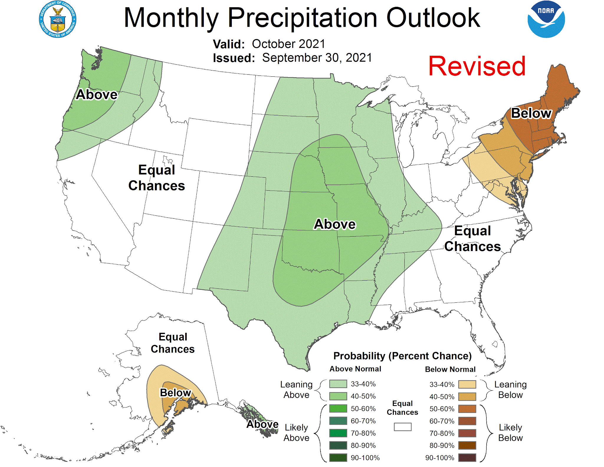
The extended precipitation forecast from the European Center through mid-November?  You guessed it.  Wetter than normal (see below).  Blue is much wetter than normal.


Why are we going to be stuck in this cool, wet situation?  

Because the large-scale upper air pattern has been stuck and will continue to be stuck, in a typical La Nina configuration, with a ridge of high pressure offshore and cool, wet northerly flow over the West Coast (see forecast below for Thursday evening for the pressures/heights around 18,000 ft).   


This configuration can be forced by the cooler-than-normal sea surface temperatures in the tropical Pacific associated with the developing La Nina.

 Water....the essential resource of our region...is back and our reservoirs, dams, and soils are being refilled.  And at least one group will be very happy:


Post a Comment

Previous Post Next Post

Iklan In-Feed (homepage)

" target="_blank">Responsive Advertisement