King Tides represent unusually high water levels, which occur when the geometry of the sun and moon are just right.
But this year, the predicted tide got a major boost in Seattle, thanks to the atmosphere.
On Friday around 9:15 AM, the water level in Seattle rose to 14.47 feet above sea level and probably was higher in the 20 minutes before (there was an outage at the site between 8:42 and 912: AM)
The previous record high tide in Seattle was 14.51 ft in December 2012. We very well might have beat it.
The result was coastal flooding throughout the area.
Near Alki Point that morning (courtesy of the West Seattle Blog).Below is the predicted (blue) and actual (red) water levesl at Seattle from the NOAA Tide and Currents website since January 3. Friday's prediction (around 12.5 ft) was WAY too low (by about 2 feet). (a red arrow indicates Friday)
Something greatly increased the high tide!
But what?
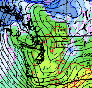
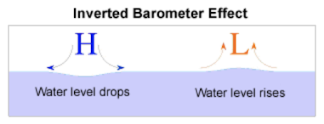
The secret was a vigorous low-pressure system and front that was going through EXACTLY at the right time (see sea level pressure forecast for 8 AM Friday, syncing in perfectly with the astronomically forced high tide.
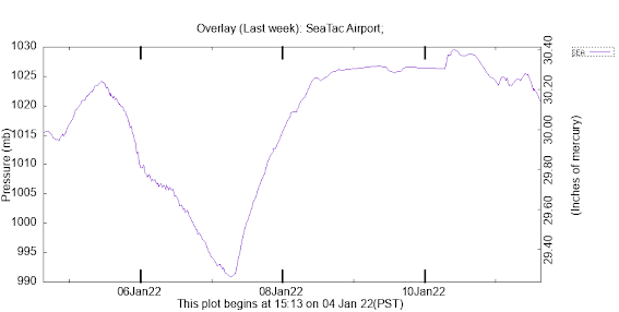
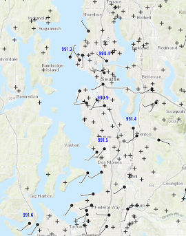
And a trace of pressure at SeaTac Airport documents the pressure plunge (see below). Pressure dropped all the way to 990 hPa from ~1025 hPa.... which is a big and rapid change.
You might ask how does the weather-related boost of the high tide compare to the steady increase observed over the past century.


Post a Comment