The great melt-out has begun in western Washington.
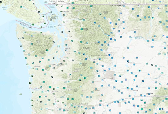
As shown below, temperatures have risen into the mid-30s to mid-40s in western Washington under the influence of moderate southerly flow in front of a cold front. Eastern Washington remains in the deep freeze, with some locations still in the teens.
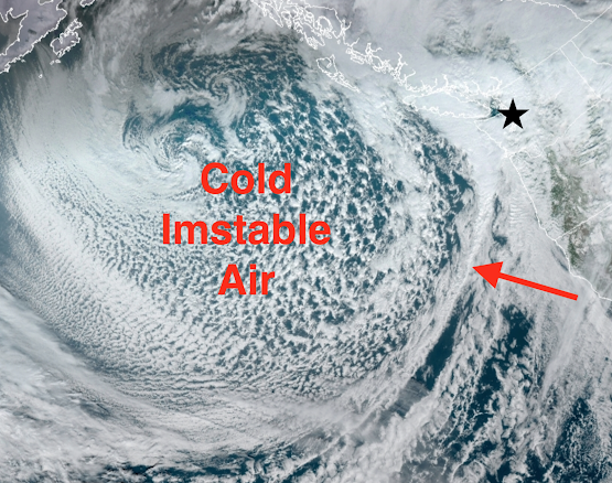
A moderately strong cold front is now approaching the coast (see visible satellite image around 1 PM, the star indicates Seattle). The warm southerly flow precedes the front. The snow level is around 2000 ft right now.
By tomorrow afternoon, the snow level will be down to 700-1000 ft, even a bit lower in heavy showers. Do not be surprised to see some wet snowflakes tomorrow if you are near sea level.
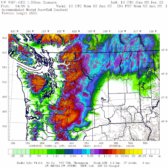
The predicted snowfall through 4 AM Monday is pretty impressive in the mountains, with 1-2 additional feet. Some extremely light snow (all melting) in the lowlands.
The big question is melting snow/ice on roadways. By tomorrow, many of the snow and ice-bound roads in western Washington will have melted out or become passable. Even today, travel is greatly improved around Seattle.
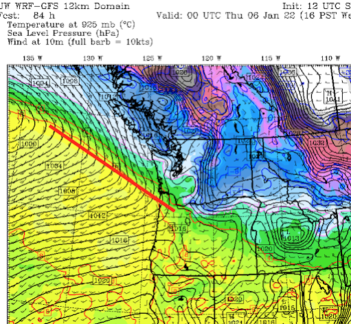
The next major action will be on Wednesday afternoon when a strong warm front will approach (see surface map for 4 PM Wednesday, warm front indicated by the red line). With cool air in place, some will see light snow that evening...but don't worry---the temperatures will zoom up with the warm front passage overnight and roads will be fine on Thursday.
_______________
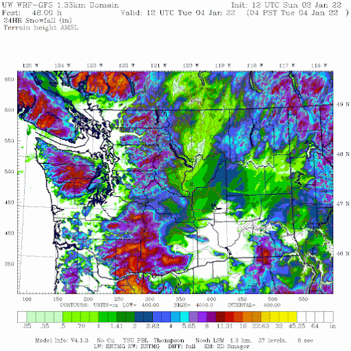
Several folks have noted that there was snow around Hood Canal and near the Olympics. This is not usual in such marginal situations, with additional lift on the SE side of the Olympic barrier. It was suggested in the model forecasts noted above, but let me show you the super high-resolution snow forecast from Sunday morning (see below). The Kitsap snow is pretty evident. Also snow in the Cascade foothills.

Post a Comment