Meteorological winter in the Northwest typically ends the third week of February, and it looks like unusually dry conditions will dominate.
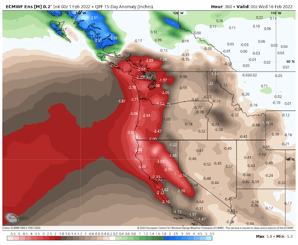
Perhaps the most skillful tool for extended prediction over the next two weeks is the ensemble of many forecasts produced by the European Center. The figure below shows the predicted difference (or anomaly) from normal for the precipitation through 4 PM on Tuesday, February 14th).
MUCH drier than normal (brown colds are 2 inches or more below normal) is predicted for much of the West Coast. This is particularly serious for California, which needs every drop it can get.
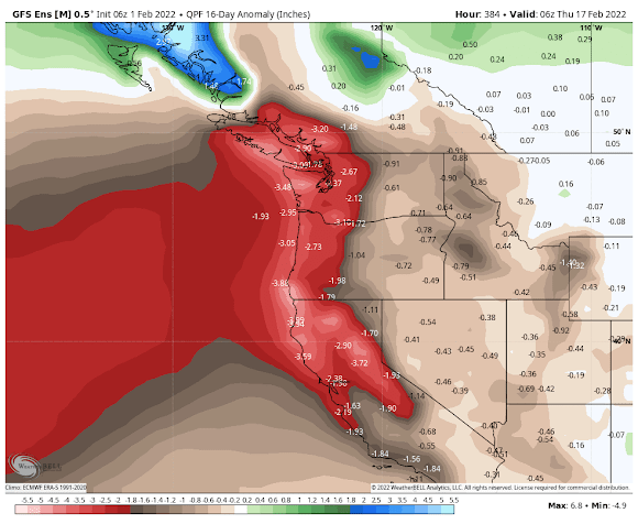
The National Service GFS ensemble system has a similar solution for the same period (see below). Very dry.
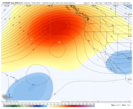
What is the origin of such Sahara-like conditions in the normally soggy Pacific Northwest?
A persistent ridge of high pressure offshore.
Let me demonstrate that to you. Here are the predicted upper-level heights (solid lines) at 500 hPa (you can think of this like pressure at roughly 18,000 ft). The colors indicated differences from normal, with red indicating much higher than typical. A huge ridge of high pressure will dominate over the northeast Pacific).
Thankfully, the Northwest has full reservoirs and normal snow as we go into this mid-winter dry period. Califonia has a decent snowpack but its reservoirs are still below normal due to the previous dry years. But at this point, there is still time for more precipitation after these dry weeks pass by, and it appears that La Nina is starting to weaken.
So stay tuned.
Post a Comment