My new podcast is out (see details below), and I cover two important topics: the radical change in our weather that will occur this weekend, and the substantial variations in local temperatures on cold nights.
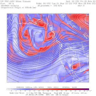
Take a look at the upper-level (500 hPa, about 18,000 ft ASL) flow this morning and on Monday night. This morning, the ridge is right on the coast--a situation associated with sinking air and sunny skies.
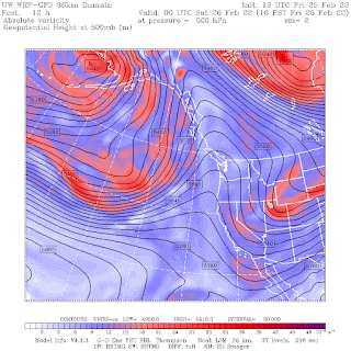
But on Monday evening, the ridge has moved inland and the Northwest is in strong southwesterly flow off the Pacific. A large trough is offshore. This is a warm/wet pattern.

My podcast gives more details on the forecast. And my podcast also describes and explains the large local variations of low temperatures on cold mornings, such as on Wednesday.
It all makes sense if you know what is going on, and you will after you listen to the podcast.


To listen to my podcast, use the link below or access it through your favorite podcast service.
Some major podcast servers:
Like the podcast? Support on Patreon
Post a Comment